
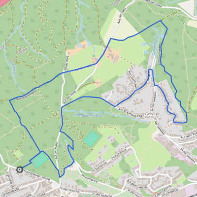
Beschreibung:
6 km, 150 Höhenmeter
Laufen, Walking (Einsteiger) – Asphalt, Waldwege
Treffpunkt: Schülinghauser Straße, Höhe Einfahrt Sportplatz Friedensplatz
Map of the route “Birkenwäldchenweg-Runde”: 6.106 m, 163 m of climbing and 157 m of descent, elevation between 188 m and 265 m, time 00:04:08. It is a loop that starts and ends at 51.35507, 7.40682 (latitude, longitude).
